Tides
The tide – is it coming in or going out?
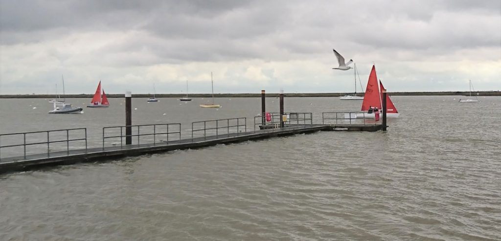
- You can generally tell whether the tide is going in or out by looking at the boats out on the moorings.
- The tide sweeps them behind the mooring buoy to which they are attached
- The tide is coming in if the boats’ sterns (rears) are facing upriver, to the west, i.e., to your right as viewed from the waterfront.
- If the tide is coming in, it is said to be flooding, or making.
- High Tide is also known as High Water.
- The tide is going out if boats’ sterns (rears) are facing towards the sea – east, downriver, to your left).
- If the tide is going out, it is said to be ebbing or falling.
- Low Tide is also known as Low Water.
- If the boats on their moorings are facing in all directions it is because it is either (a) slack water – i.e. low or high water when the tide isn’t flowing with any significant force in any direction, or (b) the wind is stronger than the tide, which often happens on neap tides.
Spring tides & neap tides
SPRING TIDES are the strongest tides, and they are DANGEROUS TO SWIM IN.
- They happen twice a month (on average), and occur over three or four days each time.
- They tend to be immediately after the Full Moon and the New Moon. (see What Causes Tides below)
- During a spring tide more water flows into the river in the six hours (or so) it takes to move from low tide to high tide.
- This means the water flows much faster.
- Spring tides can be spotted by the fact that the water is very high at high tide and very low at low tide. You can also see how the mooring buoys are partially submerged by the rush of water flowing past them.
NEAP TIDES tend to happen around the two half moons of each month.
- During neaps, high tide isn’t very high and low tide isn’t very low, because less water is filling the river.
- Neap tides are safer to swim in because the current is not as strong.
For more tidal information and advice about swimming in the river, click here.
How can you be sure if the tide is neap or spring?
The best way is to look at a tide table (see below).
This tells you whether it is a neap or spring tide, by giving the range of the tidal rise in metres.
If it says the tidal range is between 3.6 and 4.3m, it is a neap tide.
If it says it is between 4.7 and 6.01 (or more) it is a spring tide.
The more the metres, the more water is flowing into the river and the stronger flows the current.
Tide Tables
Click here for a current tide table.
What causes the tides? Turning Burnham & the Great Tidal Illusion
- When people say the tide is coming in they are describing an illusion. The water is NOT coming towards you. Instead, you are moving towards the water.
- This is because you are standing on a turning Earth, and during the flooding tide, Burnham is turning into the tidal bulge caused by the pull of the moon and the sun.
- The sun and the moon pluck the sea up into a dome of high tide 3-6 metres high, or so.
- The sun and the moon create a tidal bulge simultaneously on both sides of the planet.
- As Burnham turns into the tidal bulge, the River Crouch fills with water.
- After high tide, the river empties as the planet rotates past the bulge and as we, in Burnham, move away from the deeper water.
- 12 hours later (more or less) it happens again.
- This is because Burnham, rotating with the planet, has reached the second tidal bulge on the other side of the planet.
- The Earth’s circumference at the equator is, coincidentally enough, around 24,000 miles. It takes 24 hours for the Earth to turn once, so the equatorial rotation speed must be around 1000 mph.
- Burnham is turning at around 600 mph, because the Earth’s circumference at our latitude, 51.6283˚N, is significantly shorter than it is at the equator (0˚). In other words, we are moving more slowly in Burnham than towns on the equator, because, being further up the globe, we have less distance to travel during a single rotation. Scotland moves slower still. At the north and south poles (90˚N and 90˚S) you rotate at 0 mph because you have no distance to travel.
- It takes Burnham half a day to rotate half way round the world: 12 hours + 12 hours = 24 hours – a day.
- This is why there are two high tides, and two low tides, each day.
- Spring tides can create tidal bulges around 5 or 6 metres high.
- This is because the sun and the moon are pulling in the same line – either during a full moon when the sun is opposite the moon and illuminating its whole face – or a new moon, when the sun is effectively behind the moon and throwing no light on its face.
- During a neap tide the sun and moon are splitting their forces – with the moon pulling at right angles to the sun. This is why there are neap tides around a waxing or waning half moon.
Winds
Burnham’s coastal location, together with the flat landscape, can make the waterfront a particularly windy place to be.
The prevailing wind is from the southwest – to your right, at about ‘one o’clock’, as you face the opposite bank of the river.
Wind speed & weather
If you want to know the current wind speed and direction, and other weather information, click here to link to a Met Office-approved weather station run by local resident, Tony Nash.
Summer winds
In the summer, the Burnham waterfront often enjoys a refreshing easterly or south-easterly Sea Breeze, caused by the land heating up and pushing hot air upwards, so pulling cool air from the North Sea along the river.
The sea breeze tends to come up in the early afternoon, often around 2pm.
So, if you are sweltering away in town, pop down to the waterfront to cool down.
Winter winds
The colder winter winds often bring higher tides and can pose a risk of flooding (see below) – but this is only a serious risk if the winds are from the north, particularly the northeast or northwest.
When the wind is in these two quarters, it often means there is low pressure in the North Sea.
That can lead to flooding.
Flood Risk
Why is there a flood risk in Burnham?
If there is a deep low pressure in the North Sea, the sea water has less weight of air bearing down upon it and so rises up several metres.
Add this to the tidal bulge around the time of spring tides (described in What Causes the Tides above) and you have a serious Storm Surge.
The deeper the low pressure, the stronger the winds and the higher the storm surge.
This storm surge can then sweep down the east coast, breaching coastal defences. We live on flat land and have few cliffs to provide us with natural bulwarks against the savage sea.
Sometimes the storm surge comes through before the high tide. When it does, and, happily, it usually does, you can witness the spectacle of the river filling with water in less than an hour (it usually takes over six hours).
If the spring tide coincides with spring tide high water, then there may be trouble.
But relax – the risk of Burnham flooding has been much reduced by the recent increases in the height of our flood defences.
The sea wall around Burnham is higher than the sea wall on the south bank, so the Wallasea Wetlands will flood first. Also helping is the fact that the wind during such a flood is usually from the north, which blows the water across the river and onto the other bank.
However, global warming threatens to change all this, over time.